Our Services
We strive to continuously perfect what we do and fine tune the methods and outputs to create value.
From a single service for a very specific need to a bespoke package of services that delivers longer term benefits, or anything in between.
Your needs define us.
Aerial 2D Mapping
Digitise your project site as a high accuracy and high resolution map. Overlay your drawings, check progress, manage risk, assure compliance and minimise non-conformance.
All with survey grade geolocation precision and in any coordinate system or projection.
Share, discuss, plan and track without getting your boots muddy.
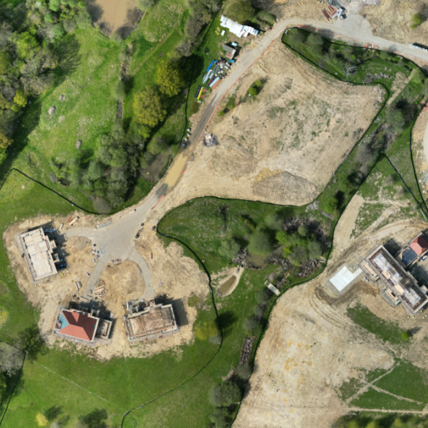
2D Map of a client's development site. Track progress and assure compliance.
Aerial 3D Modelling
Digitise your building as a high accuracy and high resolution 3D model that can be explored, measured and annotated and collaborate with stakeholders at any time and place.
Search for failing building fabric before a catastrophic and costly repair is needed.
Plan your works by overlaying 3D models, and then check compliance once complete.
No need to travel, anywhere.
3D Model of a client's residential building. Inspect, annotate, measure and share. Zero mistakes!
3D Laser Scanning
Digitise your project as a high accuracy and high density point cloud or 3D Mesh that can be explored without putting your PPE on,
Measure, annotate and collaborate make digital twins a powerful tool to operate more efficiently and effectively. All with millimetre accuracy.
Exploring VR? We can help with that too.
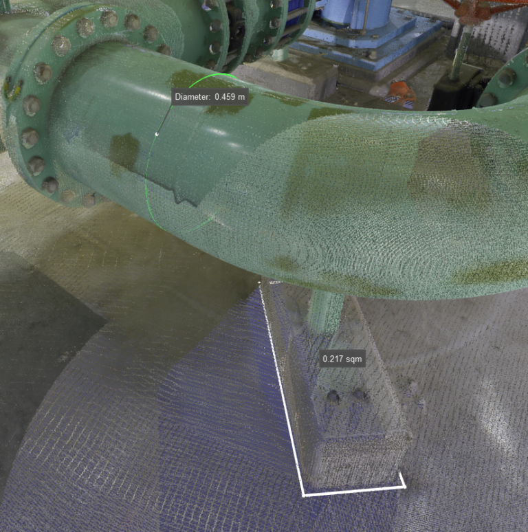
3D Model of a client's plant. Measure, collaborate and contract with minimal re-work.
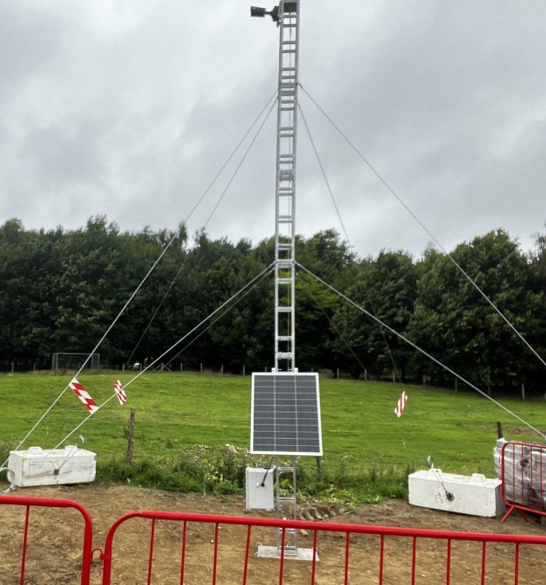
Site Timelapse Cameras
Capturing your project as it develops is useful for many reasons.
Publicity videos, compliance evidence, stakeholder briefings, H&S or security analysis, it's all possible with our NexusIQ system.
Configured and installed to meet your needs, we can use most IP cameras and incorporate solar power if needed. Date security is managed using UK based Amazon Web Services systems. Our own intuitive user interface puts all your cameras and images at your fingertips.
We can create your time lapse videos at significant point in the projects, or at the end, or both.
Managed Cloud Services
Getting quality content into the hands of your users to be able to solve today's problems and achieve tomorrow's goals is the aim.
Imagine same day processing and hosting of maps and models on high end 3D visualisation, markup and collaboration platform, or a simple 2D visualization and sharing platform.
We do this, all fully managed and without creating a burden on you or you business operations.
Secure, resilient, reliable, fast and scalable.
Meshing Services
Do you or your clients require a high quality mesh produced from point cloud or aerial photography?
We're able to produce point clouds and meshes in most common standards for you, as an end-to-end service.
We're also able to produce proprietary data sets for Leica and Bentley software ecosystems.
Let us know what you need, and we can get it done quickly and efficiently.
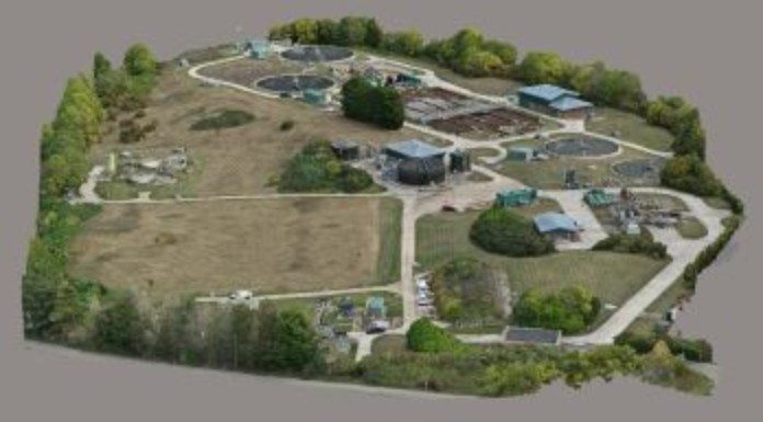
3D Meshed Model of a large industrial site in Kent.
Training Services

We offer complimentary web based training resources too all our clients. This is proven to bring client stakeholders to a level of understanding of the principles, techniques, technology and software solutions that underpin our value propositions.
Infrastructure Inspections
Detail, accuracy, precision and currency.
These attributes are what makes a good inspection service. Why not capture your roof, building or complex piece of infrastructure in a high resolution model, mode of 100's of images?
Imagine being able to see and inspect from every angle, mark it, view it and share it with anybody.
Inspect, maintain and track the fabric of your buildings.
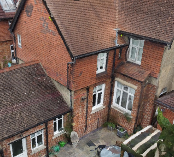
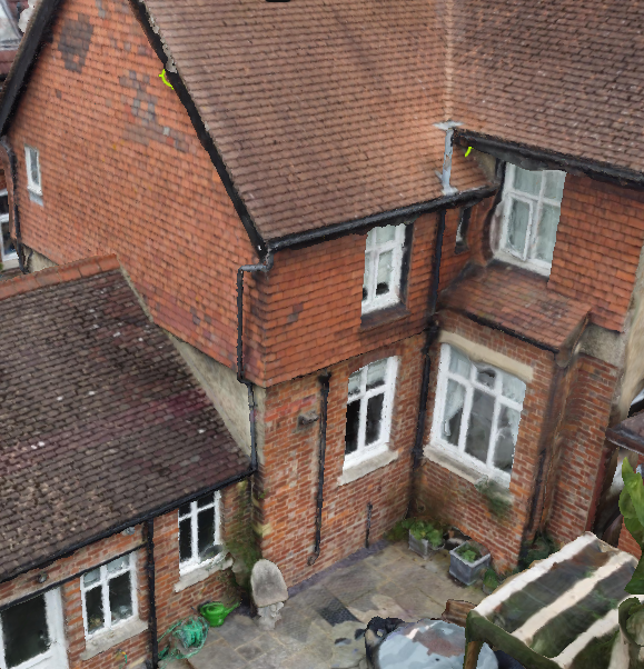
3D Model of a client's house. Find the unseen faults.
Our Toolset
We employ a suite of preferred tools.
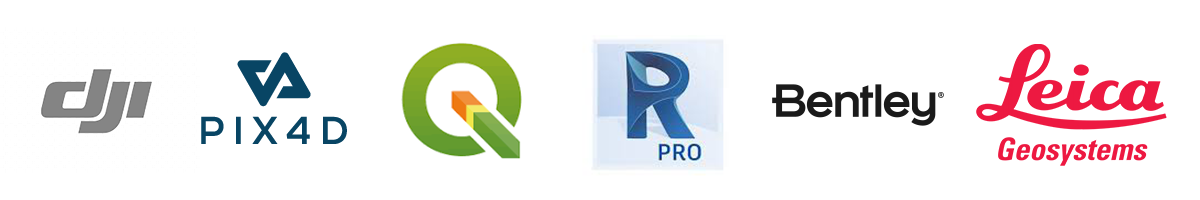
- DJI and Leica hardware to capture and digitise.
- Pix4D, Leica Geosystems and Bentley software to process.
- QGIS, Autodesk Recap, Pix4D and Leica platforms to visualise, share and collaborate.
We're software agnostic, so we can also accommodate other needs.
All logos and trademarks of other brands featured on this website are the property of their respective owners. Their use is solely for informational and illustrative purposes. The inclusion of these logos and trademarks does not imply any affiliation, endorsement, or sponsorship by the respective brands.